
Cryosphere
Nicole is inventing radar techniques to measure ice properties at scales previously unexplored. The systems she develops provide measurements that better constrain ice sheet models to improve the accuracy of sea level rise predictions.
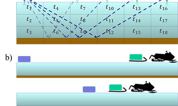
Processing-Based Synchronization Approach for Bistatic Radar Glacial Tomography
2020, Conference Paper
This novel processing based synchronization approach allows coherent long-offset radar processing. This is a key enabling technology for radar tomography of glaciers.
N. Bienert, D.. Schroeder, S. Peters, M. Siegfried
Prize Paper Award


Biosphere
2022, Conference Paper
Vegetation water stress is a key control on wildfire risk, tree mortality, and ecosystem water and carbon fluxes. Although active microwave remote sensing methods have been used to estimate vegetation water, they remain poorly validated because of the immense mismatch between the scale of radar pixel resolutions (100 m to 25 km) and field measurements (individual trees). In this study, we present a new plot-scale vegetation water measurement technique using a side-facing bistatic radar. Using field experiments and a matched filtering technique to isolate the radar signal from noise, we show that radar amplitude is sensitive to xylem water potential (a measure of tree water status). However, our results are affected by periodic noise (period of~12 hours), which may be due to radio frequency interference. We discuss potential pathways to isolate the signal and the implications of the new tree water status measurement system for global validation of microwave remote sensing.
Side-Facing UHF-Band Radar System to Monitor Tree Water Status
K. Rao, Y. Uloa, N. Bienert, N. Chiariello, N. Holtzman, G. Quetin, S. Peters, K. Winstein, D. Castelletti, D. Schroeder, and A. Konings


Near-subsurface

2018, Undergraduate Thesis
Resonance Radar Imaging
Resonance Radar Imaging (RRI) is a novel imaging technique which could unlock aquifer volume measurements. This work advances resonant imaging by estimating the volume and properties of buried spheres using a genetic optamization inversion of Mie Theory. Resonance peaks determine cross sectional area, the Physical Optics Regime yields information about shape and the backscatter strength in the Rayleigh region determines the objects volume.
N. Bienert, D. Arumugam, J. Bush, T. Kane, R. Manthena

Computational Photography
Nicole is developing equitable imaging algorithms that generate amazing photographs regardless of skin tone, and signal processing techniques that increase the speed and accuracy of autofocus.